Search Collections
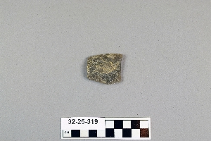
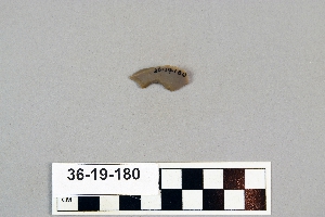
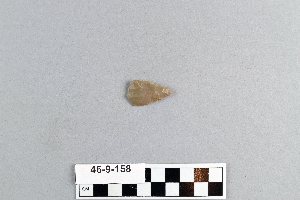
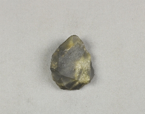
- Object[529]
- yes[529]
- american[494]
- asian[15]
- near eastern[20]
- abbott farm[6]
- abilene[3]
- alibates creek[16]
- anderson lake[32]
- apache canyon[3]
- bainbridge (pennsylvania)[7]
- banquete creek[5]
- beck forest lake[34]
- berks county[11]
- beth shean[20]
- bivens estate ranch[16]
- blowout mountain[7]
- boyertown[11]
- bucks county[26]
- california (state)[6]
- canadian river[11]
- chickies[17]
- clovis[91]
- corpus christi[7]
- curry county[6]
- delaware valley[9]
- eddy county[4]
- elm creek[3]
- fresno county[6]
- garrett[5]
- georgetown[3]
- gravel pit[16]
- gulf of mexico[3]
- harding county[5]
- hokkaido[4]
- honshu[9]
- israel[20]
- japan[14]
- kanagawa prefecture[7]
- kintnersville[8]
- kroenig ranch[3]
- laguna madre island[4]
- lake[10]
- lancaster county (pennsylvania)[49]
- live oak peninsula[9]
- livingston county (new york)[4]
- locust grove[5]
- louisiana[8]
- mercer county[46]
- miniosa draw[10]
- mississippi[9]
- mississippi valley[6]
- montgomery county (pennsylvania)[3]
- mora county[3]
- muerto creek[5]
- natchez (mississippi)[6]
- near abilene[9]
- near bueyeros[5]
- near clovis[19]
- near eden[5]
- near levy[3]
- near nara visa[10]
- near san jon[3]
- near taos[4]
- near tecolote[6]
- near trenton[6]
- near tucumcari[10]
- new jersey[64]
- new mexico[199]
- new paltz[4]
- new york[14]
- north carolina[3]
- northampton county[6]
- nueces county[17]
- overpeck site[8]
- padre island[3]
- pechoqueolin creek[4]
- pennsylvania[117]
- polard lake[14]
- pot creek[4]
- potaler clovis[3]
- pottstown[3]
- pueblo mound[3]
- quay county[31]
- railroad mountain[7]
- rincon[8]
- rockport[5]
- san miguel county[6]
- site 10[14]
- site 2[13]
- site 5[7]
- sweetwater county[6]
- taos county[4]
- texas[71]
- tranquillity[6]
- tranquillity site[6]
- trenton[40]
- troutman ranch[10]
- ulster county[4]
- united states of america[332]
- watrous[4]
- west bloomfield[4]
- witmer's farm[7]
- wyoming[6]
- yokohama[7]
- finley site[1]
- central california phase[6]
- chalcolithic[13]
- early bronze i[6]
- early horizon[6]
- historic[4]
- iron age ia[1]
- iron age ib[1]
- jomon[14]
- late bronze iib[1]
- late paleolithic[1]
- middle horizon[6]
- modern[1]
- neolithic[10]
- paleoindian[1]
- paleolithic, japan[6]
- yayoi[7]
- algonquin[2]
- cherokee[3]
- cody cultural complex[1]
- indian[1]
- iroquois[5]
- japanese[11]
- jomon[14]
- late paleolithic[1]
- leni lenape[8]
- merikoke[1]
- meroc[1]
- merric[1]
- paleolithic[6]
- yayoi[7]
- "mound" - adobe walls[1]
- 2 mi. w. of gravel pit near clovis, n.m.[1]
- 24.5 ft. below surface found with charcoal #32.29[1]
- abbott farm[1]
- alongside mammoth tusk[1]
- alongside of mammoth tusk[1]
- anderson lake, about 15 mi. s.e. of clovis, n.m.[20]
- bank of elm creek 7.5 mi. south of abilene[1]
- basin site[3]
- bison kill/processing area[1]
- blow-out[1]
- c' - 9-south[1]
- camp site[5]
- creek bed of elm creek 7.5 mi. south of abilene[1]
- deep hearth on south side of erosion island[1]
- excavated area at junction of squares 10z and 10aa on hard surface (surely of pink consolidated soil)[1]
- field near town[1]
- first terrace surface[4]
- found in place in blue sand with extinct bison[1]
- from "blow-cuts" near finley site, near eden; on surface[1]
- from "blow-outs" near finley site, near eden[4]
- from roadside gutter[1]
- from two camp sites on old cammann property.[1]
- garden of naval home on gray's ferry road[1]
- hays stewart farm, operation ii, surface[2]
- just above mammoth tusk[1]
- killpecker dune field[1]
- lake 15 mi. west[1]
- lake south west[1]
- mescal pit in small canyon north of dark canyon near carlsbad, n.m.[1]
- near stake 10aa[1]
- old lake 2 mi. sout of gravel pit near clovis, n.m.[1]
- old lake 2 mi. south of gravel pit near clovis, n.m.[2]
- rectangular pit house, 2d/2s, depth 23 in. among ashes under fragment of stone -- near corner within pit house.[1]
- rectangular pit house, 2d/36s[1]
- rectangular pit house, 2d/3b, depth 25 in.[1]
- rectangular pit house, 2d/40s, depth 13 in., on plaster.[1]
- rectangular pit house, 2d/41s, depth 13 in. lying immediately on horizontal plaster.[1]
- rectangular pit house, 2d/49s[1]
- rectangular pit house, 2d/4s[1]
- rectangular pit house, 2d/52s, depth 9 in., above floor in "wash" near platform "break"[1]
- rectangular pit house, 2d/6b, depth 24 in.[1]
- rectangular pit house, 2d/8s[1]
- rectangular pit house, 2d/?b[1]
- region around rockport[4]
- sand "blowout" 20-25 miles northeast of carlsbad[1]
- sand dune surface site near nugent[1]
- shell mounds[1]
- shores of delaware river at morrisville, pa., and trenton, n.j.[1]
- square 11aa, probably easterly side of "11z area"[1]
- square 11z, 4.00 to 5.00 meters north of stake 11z; on hard sand surface at base of white sand[1]
- square 12x, 2.00 meters west of stake 12x, in pocket of "hard soil" (below white sand and/or silt)[1]
- square 12y?[1]
- sunshine valley[2]
- surface[21]
- surface around gravel pit near clovis, n.m.[1]
- surface in blown area[1]
- surface near high terrace, 13 mi. south of abilene[1]
- surface site[7]
- west dump at side of old road leaving the north east corner of the gravel pit[1]
- west dump of gravel pit, surface[1]
- willamette river[1]
1 - 32 of 529 Records