Search Collections
- Object[735]
- no[735]
- american[735]
- arrowhead[1]
- drill point[1]
- flake[1]
- flake knife[1]
- flakes[1]
- gunflint[4]
- hand axe[1]
- knife[39]
- knife blade[1]
- point[2]
- scraper[735]
- spearhead[1]
- abilene[23]
- alaska[73]
- alibates creek[16]
- anclota estuary[5]
- anderson lake[14]
- antelope creek[19]
- aransas county[5]
- arizona[4]
- beck forest lake[8]
- bivens estate ranch[11]
- blowout mountain[6]
- brownsville[6]
- buffalo gap[11]
- california (state)[4]
- canadian river[65]
- clovis[19]
- colorado[4]
- cottonwood creek (texas)[7]
- cumberland county (tennessee)[6]
- deal[10]
- diamond (ohio)[8]
- east tennessee[27]
- elm creek[57]
- ewing and bragdon site[39]
- fayette county (pennsylvania)[6]
- florida[8]
- frenchman's bay[39]
- fresno county[4]
- gould ruin[18]
- grassy cove[6]
- gravel pit[3]
- gulf of mexico[3]
- hancock county (maine)[39]
- handley ranch[22]
- hardin county[5]
- indian hill[23]
- indiana[8]
- jackson ruins[4]
- kansas[3]
- kentucky[4]
- kings ruins[12]
- kraale[5]
- kroenig ranch[3]
- laguna madre island[8]
- laguna madre islands[4]
- landergin[29]
- lendsey farm[29]
- livingston county (new york)[4]
- logan (new mexico)[6]
- maine[39]
- marshall county[3]
- mathews ranch[9]
- monongahela river[6]
- near abilene[163]
- near albany[9]
- near clovis[11]
- near englewood[3]
- near taos[4]
- new mexico[63]
- new york[5]
- north america[3]
- north carolina[4]
- nueces county[9]
- ochiltree county[4]
- ohio[45]
- ohio county[3]
- padre island[3]
- palmyra township[8]
- pennsylvania[25]
- pinellas county[6]
- point barrow[8]
- point barrow region[27]
- point hope[31]
- portage county[8]
- pot creek[4]
- potter county (texas)[4]
- quay county[10]
- railroad mountain[4]
- rockport[9]
- rosson's ranch[11]
- site 2[5]
- site 5[4]
- smith county[4]
- taos county[4]
- taylor county[4]
- tennessee[12]
- texas[381]
- tranquillity[4]
- tranquillity site[4]
- unalakleet[4]
- united states of america[650]
- unites states of america[8]
- utah[4]
- utkiavik[10]
- utkiavin[15]
- watrous[4]
- west bloomfield[4]
- west virginia[4]
- wolf creek[22]
- wyatt farm[26]
- "mound" - adobe walls[1]
- 0.75 mi beyond bridge[4]
- 0.75 mi. beyond bridge[22]
- 24.5 ft. below surface found with charcoal #32.29[1]
- 6 miles below handley ranch[3]
- anderson lake, about 15 mi. s.e. of clovis, n.m.[12]
- bank of elm creek 7.5 mi. south of abilene[1]
- basin site[1]
- below surface/above main floor of burnt house[1]
- callo del oso[2]
- camp site[2]
- centre line[9]
- creek bed of elm creek 7.5 mi. south of abilene[1]
- dr. ray's site on clear fork of brazos river[2]
- elm creek near surface site[1]
- elm creek surface site[25]
- excavated area at junction of squares 10z and 10aa on hard surface (surely of pink consolidated soil)[1]
- first terrace surface[4]
- found 100 yards from putman pit[1]
- from "blow-outs" near finley site, near eden[2]
- from rock shelter[1]
- gravel pit[11]
- house 118[1]
- house 119[2]
- house 120[1]
- mesa site[6]
- near mouth of elm creek[26]
- near stake 10aa[1]
- north of cacimbas, surface[1]
- old lake 2 mi. sout of gravel pit near clovis, n.m.[1]
- old lake 2 mi. south of gravel pit near clovis, n.m.[1]
- paint creek[25]
- rectangular pit house, 2d/2s, depth 23 in. among ashes under fragment of stone -- near corner within pit house.[1]
- rectangular pit house, 2d/36s[1]
- rectangular pit house, 2d/3b, depth 25 in.[1]
- rectangular pit house, 2d/40s, depth 13 in., on plaster.[1]
- rectangular pit house, 2d/41s, depth 13 in. lying immediately on horizontal plaster.[1]
- rectangular pit house, 2d/49s[1]
- rectangular pit house, 2d/4s[1]
- rectangular pit house, 2d/52s, depth 9 in., above floor in "wash" near platform "break"[1]
- rectangular pit house, 2d/6b, depth 24 in.[1]
- rectangular pit house, 2d/8s[1]
- rectangular pit house, 2d/?b[1]
- region around rockport[8]
- rossen's ranch near lawn[11]
- ruin along ancient ditch near englewood[3]
- sand dune surface site near nugent[1]
- sand site[9]
- site 40[1]
- site 48 (dewitt farm)[1]
- square 11aa, probably easterly side of "11z area"[1]
- square 11z, 4.00 to 5.00 meters north of stake 11z; on hard sand surface at base of white sand[1]
- sunshine valley[2]
- surface[41]
- surface collection[1]
- surface near deal[9]
- surface near high terrace, 13 mi. south of abilene[1]
- surface site[37]
- surface site in cotton field 1 mi. e. of lawn[3]
- surface site in cotton field mile e. of lawn[11]
- surface site in cotton field mile e. of lawn.[1]
- surface site near abilene[13]
- village site near handley ruin[1]
- actual citation[13]
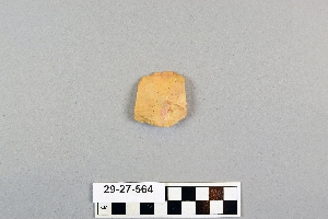
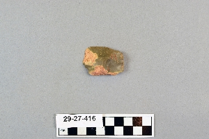
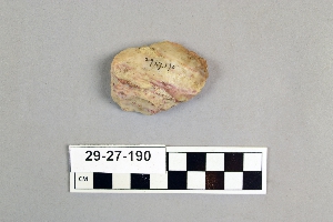
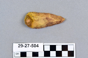
1 - 32 of 735 Records